
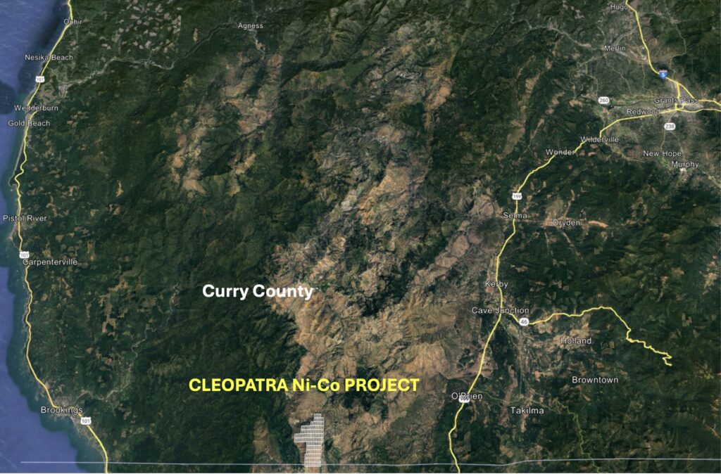
The Cleopatra Property (“Cleopatra” or the “Property”) contains a historical resource of 39.5 Mt of nickel-bearing laterite grading 0.93% nickel, representing 743 million pounds of contained nickel. Cleopatra is located 18 km west of the small town of O’Brien (Figure 1) and is adjacent to the California-Oregon border within Curry County.
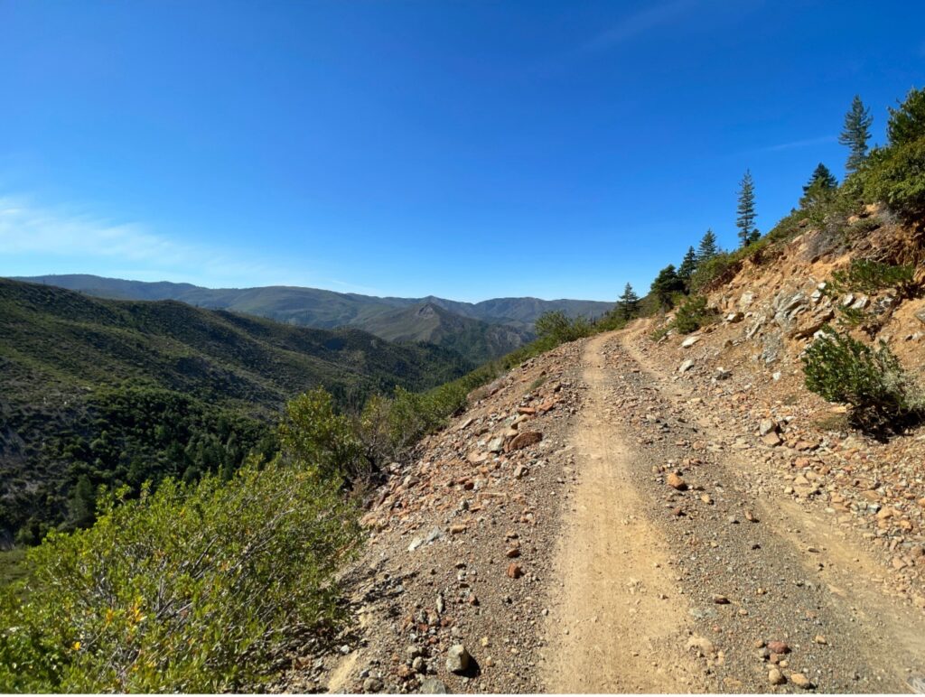
Cleopatra is in a mountainous forested area that can be accessed from US Highway 101 (from the north) or from Highway 199 (from the south). Access to the south edge of the Property is possible via four-wheel drive truck (Figure 2). Access within the property is more difficult but much of the mining claims can be accessed by side-by-side or quad-runner. Much of the tree cover at Cleopatra is absent due to recent forest fires.
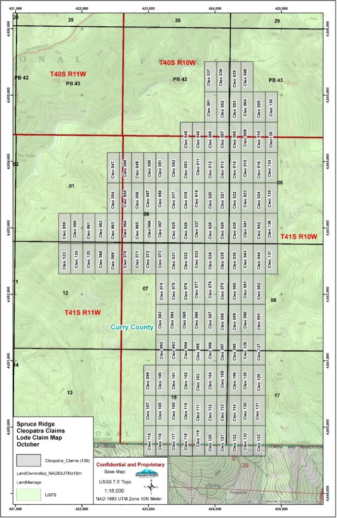
The Property consists of 139 Lode mining claims (Figure 3) covering a total area of 1,162 ha (2,872 ac). The claims are located on Federal land under control of the Bureau of Land Management. Exploration permits for sub-surface work are subject to approval by the Forest Service. Advanced exploration where more than one acre of land is disturbed or where drilling exceeds a maximum depth of 50 feet is subject to permits issued by the Oregon Department of Geology and Mineral Industries (“DOGAMI”).
Nickel was discovered in the region as far back as 1881. Nickel laterite is present at surface in the form of soil and rock. Accumulation of soil and saprolite at depth may reach a vertical depth of 50 feet in some areas as summarized by Ramp (1978). Historical assays averaged 1.0% nickel, 0.10% cobalt and 1.80% chromium. The best historical assay was 1.61% nickel over 7.5 feet at surface in auger hole AJG-15.
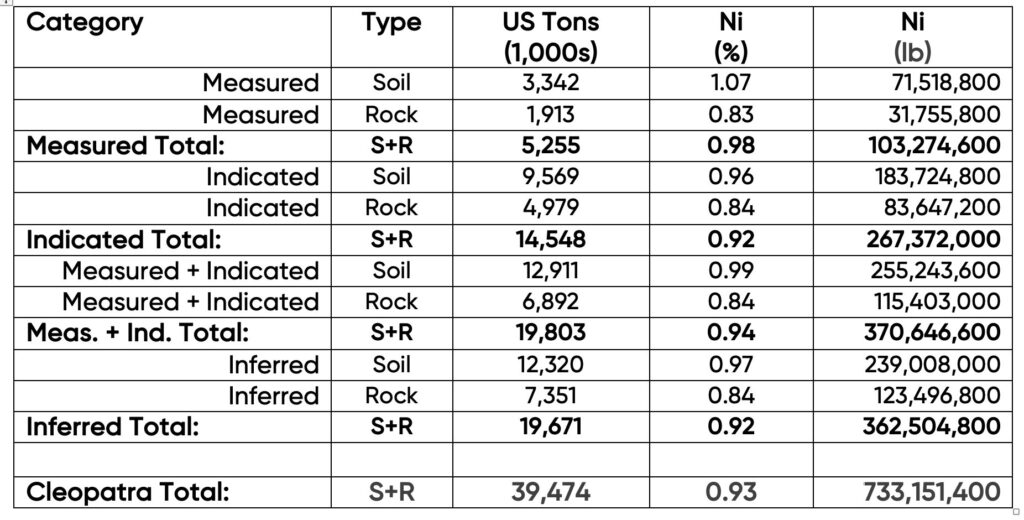
The Red Flat Nickel Corporation (“Red Flat Nickel”, now “Homeland Nickel”) conducted an extensive exploration program during 2007-2008, consisting mainly of augered holes, trench sampling and surface sampling. This program defined a resource of measured, indicated, and inferred nickel (see Table 1). A subsequent report (Rancourt, 2009) was never published so the resource is classified as historical and does not meet NI 43-101 standards for disclosure.
Based on the 2007-2009 exploration program a total historical resource of 39.5 Mt grading 0.93% Ni was delineated. This resource represents 743 million pounds (337 thousand tonnes) of contained Ni.
The resource at Cleopatra was derived primarily from hand-augering on a uniform 90 m by 90 m (300 ft by 300 ft) grid. The deepest auger hole was 7 m (23 ft) with only 3 auger holes deeper than 6.2 m (20 ft). The average exploration depth was 2.5-3.7 m (8-12 ft). Cobalt (Co) and Chromium (Cr) are also present. A typical surface exposure of the laterite is shown in Figure 4. The material at surface is predominantly soil but mineralized rock is also present.

Cleopatra contains a higher-grade zone that covers roughly 30% of the mining claims (384 ha or 949 ac) and where nickel grades average 1.12% Ni (Figure 5). This area will be the focus of a future exploration program (subject to permitting) whereby Homeland Nickel will extend the exploration depth to 15 m (50 ft) by sonic drilling and acquiring a bulk sample of laterite for metallurgical work.
Homeland has also submitted an exploration permit to reproduce the original exploration work of Red Flat Nickel to produce a new mineral resource estimate in NI 43-101 format.

The higher-grade area at Cleopatra represents an approximate tonnage of 8-10 Mt per vertical metre. This suggests that the higher-grade portion of the resource could more than double the total resource if the laterite extends to a depth of 15 m (50 ft) or more. The higher-grade area represents only 30% of the property and historical work has confirmed the presence of nickel mineralization with grades of 0.7% Ni and higher across almost all remaining claims.
Of the 139 mining claims at Cleopatra, only 13 claims have received no exploration work. The remaining 126 claims all have confirmed nickel laterite located on them.
Based on the above analysis we believe Cleopatra to be the largest undeveloped nickel resource in the continental United States. The resource sits at surface and is easily mined.