The Josephine Creek Property (“Josephine” or the “Property”) is located in Josephine County, approximately 8 km west of the town of Cave Junction near Highway 199 (see Figure 1). Access to the property is via local roads from Highway 199 at Kerby, west on Finch Rd to Westside Rd and then onto the property by local trails. Mineralization occurs as a series of nickel laterite lenses that are exposed along the western edge of Josephine Creek.
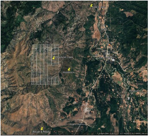
The Property consists of 174 Lode mining claims that cover a total area of 1,455 ha (3,595 ac). The claims are located on Federal land administered by the Bureau of Land Management and are within the Siskiyou National Forest which require permits from the Forest Service for exploration beyond surface sampling. The area is open for staking and was staked directly by Homeland in 2024 through a local contractor.
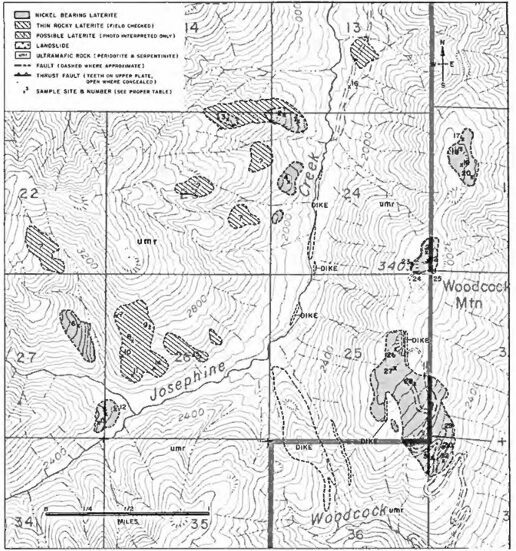
Exploration for nickel laterite has occurred from the 1950s to 1970s both west of Josephine Creek and at nearby Woodcock Mountain 4 km to the east. A total of thirteen lenses of lateritic soil and rock were excavated and documented.
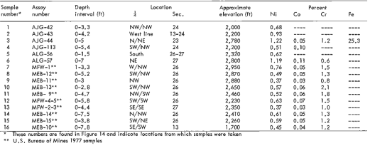
Results from previous work (Figure 2 and Table 1) include 1.22% nickel over 5 feet from surface in auger hole AJG-44 (located within section 23) and 1.19% nickel over 7 feet in ALG-57 (in section 27) within an area of mapped laterite extending across 190 ac and having a maximum depth of 30 feet. Cobalt and chromium were also sampled.
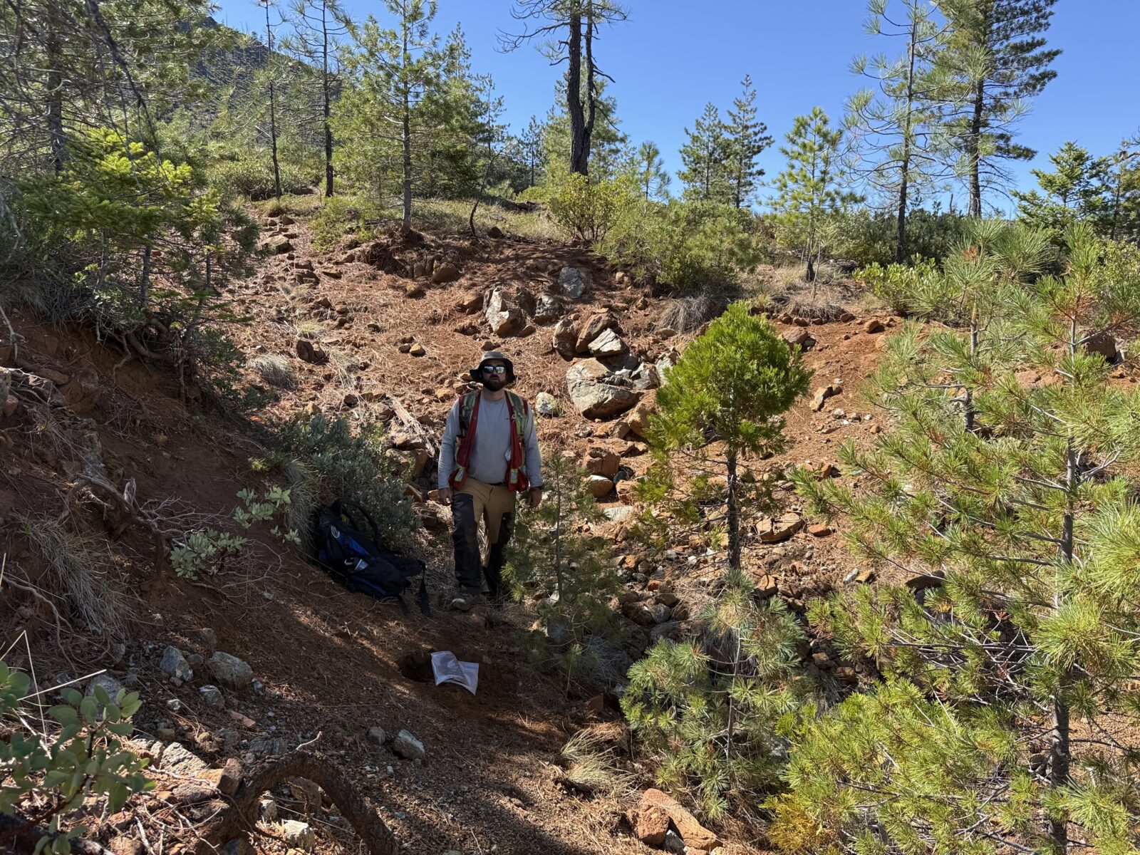
Sampling by Homeland in 2025 (see Figure 3) consisted of collecting 74 surface samples across 22 mining claims (less than 15% of the total claims). All sampled claims contained nickel in laterite with grades averaging 0.76% nickel over a range from 0.31% to 1.21% nickel and with 10 samples grading 1.00% nickel or higher. Sample assay results are summarized in Table 2. Along the northern traverse, nickel laterite was sampled across a linear distance of 1.9 km.
The 2026 exploration program at Josephine Creek will focus on completing the surface sample assaying on all claims to determine the extent of the nickel laterite soil. Subsequent work will involve auger hole drilling to determine the volume of laterite present and the grade of nickel versus depth. Augering is typically performed on a uniform grid (300 ft) to a maximum depth of 50 feet.