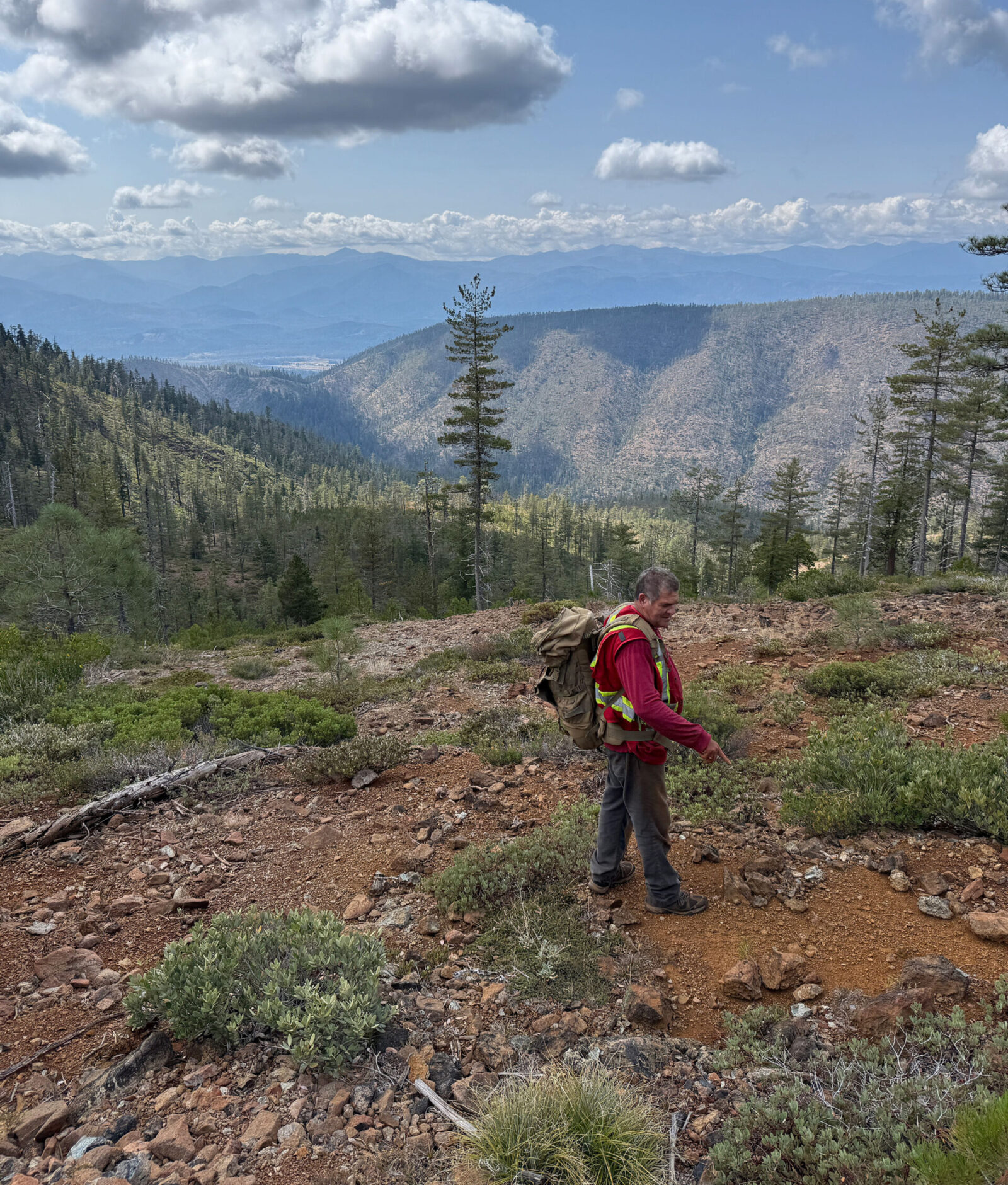
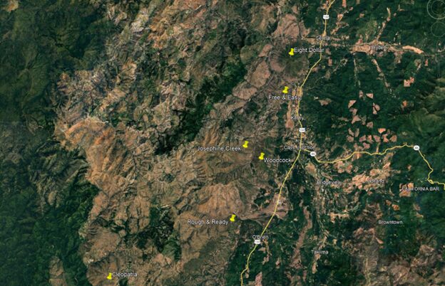
The Woodcock Mountain Property (“Woodcock” or the “Property”) is located in Josephine County, approximately 4 km west of the town of Cave Junction near Highway 199 (see Figure 1). Access to the property is from Highway 199 at Kerby, west on Finch Rd to Westside Rd and then onto the property by local trails.
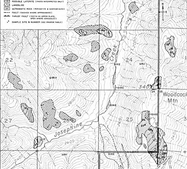
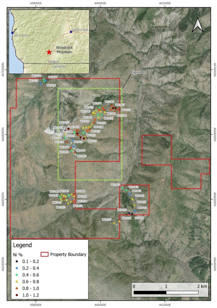
Mineralization occurs as nickel laterite lenses that are exposed along the plateau of Woodcock Mountain and having a strike direction north to south. There is one primary lens and two secondary lenses (Figure 2) but evidence suggests the lens are connected over a larger area.
Historical work at Woodcock has been extensive and well documented. The best part of the trend was acquired by RNR Resources LLC which has held their mining claims for over 30 years. These claims, an estimated 350 ac in size, were acquired by Homeland in 2025.
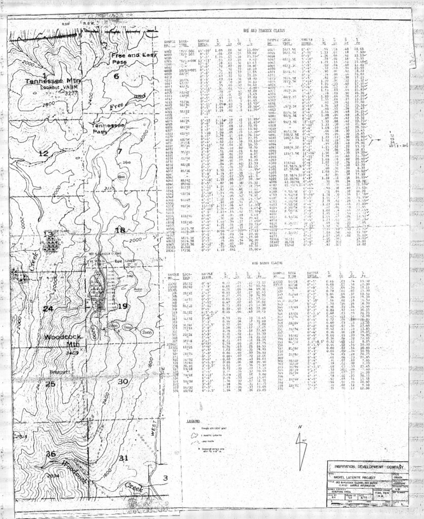
In 1949, Ralph Mason, a mining engineer with the Oregon Department of Geology and Mineral Industries, wrote a report on Woodcock Mountain that summarized exploration from 1947 covering an area 1,700 feet by 7,000 feet (1.1 sq km). In addition to surface mapping, an auger hole program was conducted consisting of 16 holes sampled at one-foot intervals downhole (assayed for nickel and chromite). The average grade over the 16 holes was 0.98% nickel. The minimum depth augered was 3 feet and the maximum was 18 feet, with an average depth to 8.2 feet. Individual assays ranged from 0.29% to 2.02% nickel. A bedrock intersection of garnierite (higher-grade nickel mineral) was also discovered as was boxwork silica.
Previous exploration at Woodcock by industry included work by Inspiration Development Corporation and Hanna Mining Company in the 1970s that uncovered nickel laterite across a strike length approaching 3 km with up to 2.13% nickel in assay (Figure 3).
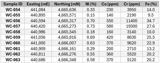
In 2025, Homeland staked 32 mining claims prior to making the RNR Resources acquisition for an approximate combined property size of 400 ha (990 ac). After the staking program, Homeland visited the Property and collected surface samples across the southwest claims the Company had staked finding grades up to 0.69% nickel (see Figure 4). All samples contained nickel in laterite.
In 2026, Homeland will conduct an auger hole program to define an initial resource at Woodcock Mountain. This work will be carried out on a 300-foot square grid with auger holes drilled to a maximum depth of 25 feet. Additional surface assays will also be taken. This work is subject to approval by the Forest Service in the form of an approved Plan of Operation.